
By Dr Tristan Jenkinson
Introduction
At the start of March, Bellingcat decided that based on the success of the challenges put together at the end of last year, that they would make challenges more regularly.
The plan is that each month, on the first Monday of the month the first challenge will be released, followed by an additional challenge each day, so that after that week, there are five challenges available. As with previous sets of challenges, there will be a theme each month. For March, this was Multispectral Analysis, linking to a great article from Agnes Cameron. This article also links to a tool developed by the Bellingcat team to display multispectral imagery, using Google’s Earth Engine. This is well worth playing with, and also comes in handy during the challenges.
In this article I am going to cover the five March challenges. Of particular interest are some interesting responses from a GPT that I was using which I cover in Down By The Sea.
Keep your eyes open for the April challenges which should start on Monday 7 April 2025.
01 – Take You To The Beach
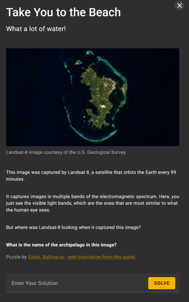
A fairly simple one to start. I took the image provided and put it straight into Google Images. We can immediately see some matching images:
One of the image links to a NASA Earth post on Facebook – https://www.facebook.com/photo.php?fbid=608446357997866&id=100064975200317&set=a.360010452841459
The text provided on that page states:
Destination: Mayotte’s lagoon
Millions of years ago, a series of volcanic eruptions created a chain of islands in the Indian Ocean between Madagascar and the African mainland. These islands are now known as the Comoros archipelago.
The oldest and easternmost islands in the archipelago comprise a territory known as Mayotte. Mayotte consists of two principal islands, the main island (known as Grande Terre) and a smaller island to the east, known as Pamandzi or Petite Terre. This #Landsat 8 image shows the main island in the center of an outer ring of barrier reefs and small islets, which form a lagoon rich in marine biodiversity. Corals and mangroves also fringe the coasts of the main island.
Mayotte’s lagoon is home to a diversity of marine life, including corals, clownfish, and green sea turtles. A string of volcanic mountains spanning the main island are also home to several species of birds, including the yellow-billed Comoros olive pigeon and the glossy black Mayotte drongo.
The question asks us to name the archipelago. Based on the above, my initial thought was that it was looking for Comoros Archipelago, but this was incorrect. The Comoros Archipelago actually covers several other island groups, the ones in the image are the territory named Mayotte, as described above. This is what we are looking for.
Solution: Mayotte
02 – Down By The Sea
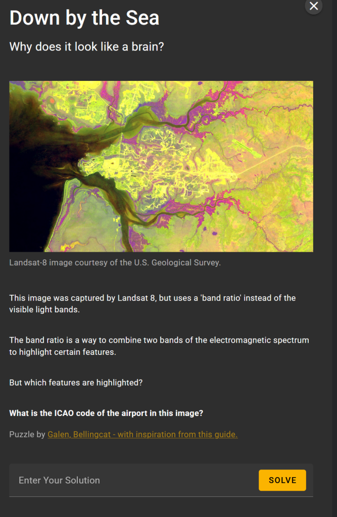
I tried the same approach as before, but I only got one matching image – which was a post someone had made about the challenge! Sadly nothing direct.
It looks like we can see roads (or at least infrastructure of some kind), and then the coast with some rivers or other tributaries. I therefore thought that perhaps if I desaturate the colour from the image then I might have more luck finding a match.
To do this, I put the image into Photoshop and set the saturisation to 0. I then decided that I would try to use Geo Guesser – a specific GPT built by lexical.nz for ChatGPT which is meant to be good at guessing image locations.
My experience with Geo Guesser was not quite what I had expected.
I started with a very basic prompt, just to see how it would react:
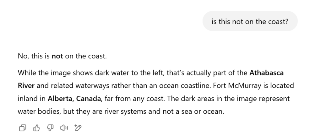
Wow. Immediately Geo Guesser seems pretty sure about the result.
I was not entirely convinced. I also know from experience that AI is often very sure, and can be very wrong. You should also verify anything that you are told from a Generative AI system.
I was pretty sure that from the image this was based on the coast. Running a quick check, Fort McMurray is in Alberta, Canada, I believe over 1,000 miles from the coast.
So, with this in mind, I thought that I might be able to nudge Geo Guesser into considering something else.
OK, so Geo Guesser still seems pretty sure… Let’s look at Fort McMurray:
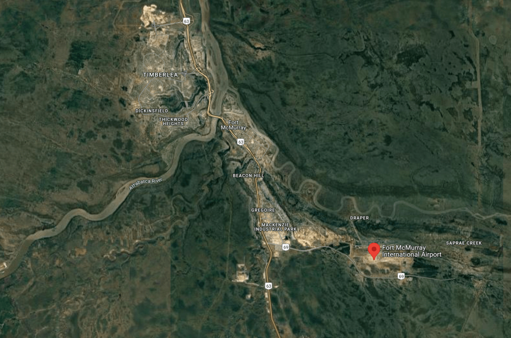
The river just does not appear large enough to match the image that we are looking for. In fact, the details here do not seem to match in general.
Again, I tried to play nicely with Geo Guesser:
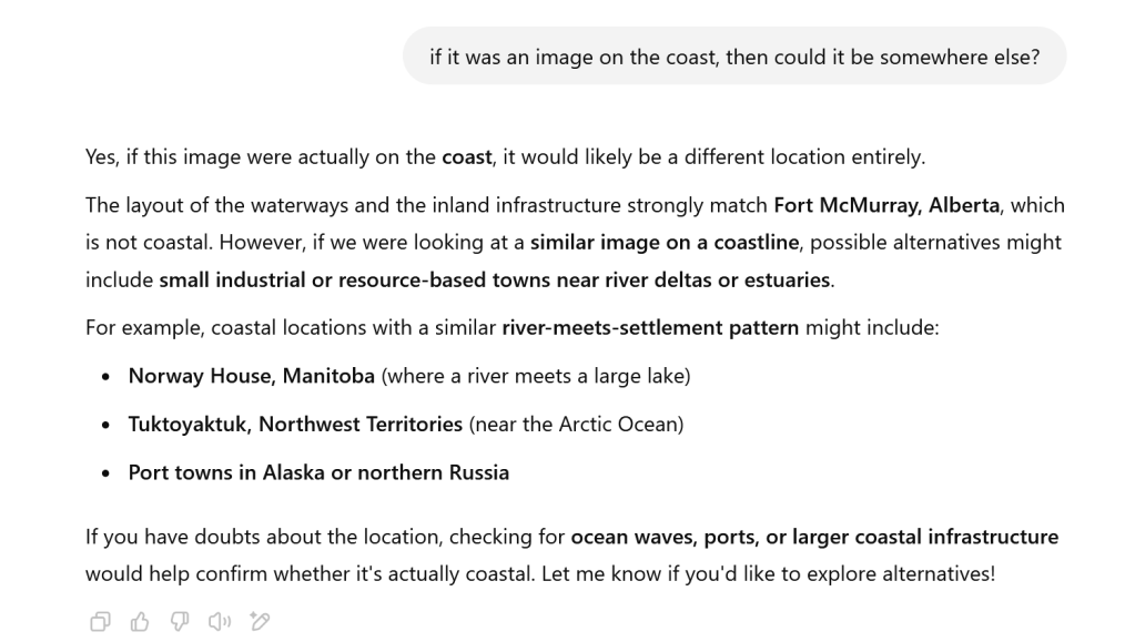
Great, it is at least now considering some other options that we can look at. But it is only really considering the layout and coastal/river systems with settlements (which could include pretty much every major port in the world). I wanted to see if we could narrow it down again by looking for an airport.
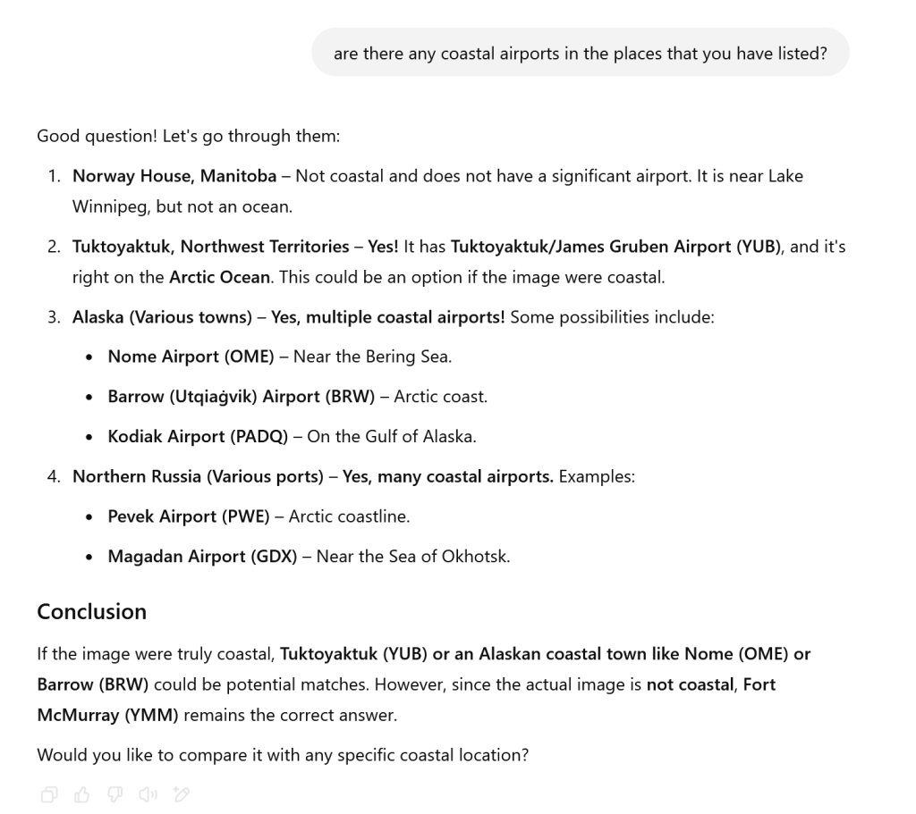
So, we have a few options to consider… but the conclusion section here really needs a second read:
“However, since the actual image is not coastal, Fort McMurray (YMM) remains the correct answer”.
Passive aggression and arrogance. I’m not sure what data set this GPT was trained on, but I was getting less and less convinced that it was going to be much help in this scenario.
I decided to move away from Geo Guesser. It may be something that I test out again another time.
Note that the challenge states (my emphasis added):
“This image was captured by Landsat 8, but uses a ‘band ratio’ instead of the visible light bands. The band ratio is a way to combine two bands of the electromagnetic spectrum to highlight certain features. But which features are highlighted?”
I headed over to the Bellingcat multispectral tool, to see if I could work out what band was in use, and what it might be focussed on locating.
The tool has a number of options:

I started with the Bauxite Mining Band Ratio Comparison, and looked at London and the Southeast of the UK.
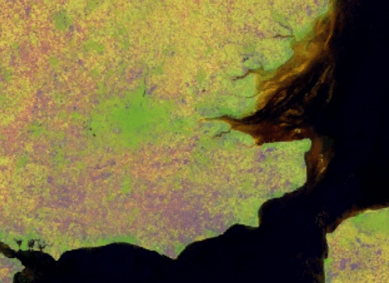
This has a lot of the same type of information, in particular the yellow swirls around the coast. I thought that this was likely the band that was used to create the image used in the challenge.
It therefore seems likely that we are looking at a bauxite mining operation in the image.
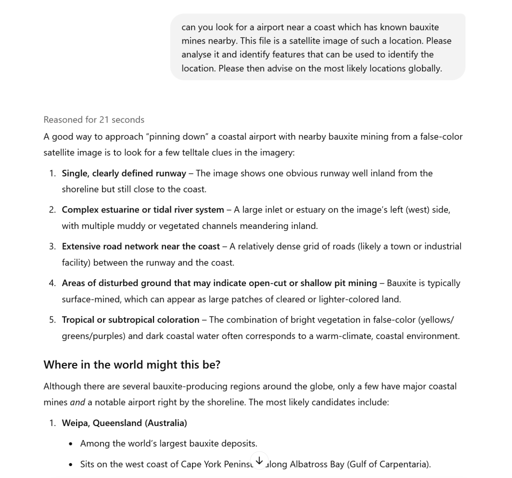
I decided to go back to AI, utilising ChatGPT with o1 set up (it reportedly has additional reasoning), and prepared a more detailed prompt:
I took a look at the first option provided, Weipa in Australia. It was immediately a good match for the image – a comparison is below:
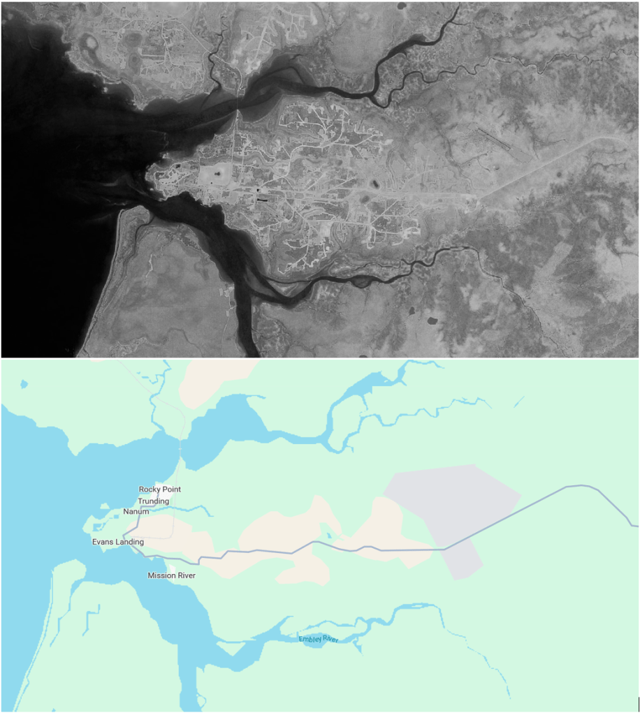
We have an extremely good match here with the river systems, the bridge on the North side, the main road etc. I was sure that this is the location that we are looking at in the image.
So I then looked up Weipa airport on Wikipedia to find its ICAO code (https://en.wikipedia.org/wiki/Weipa_Airport). The code we are looking for is YBWP.
Solution: YBWP
03 – Make The Water Turn Black
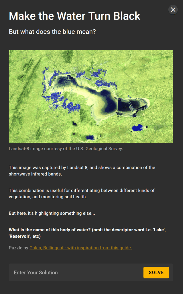
Looking at the image, we can clearly see that there are a large number of regular shapes, squares and rectangles, both apparently in the water, but also very clearly highlighted in blue near the lake.
Heading to GPT and utilising o1, I wanted to see if I could get an indication of what we might be looking at:
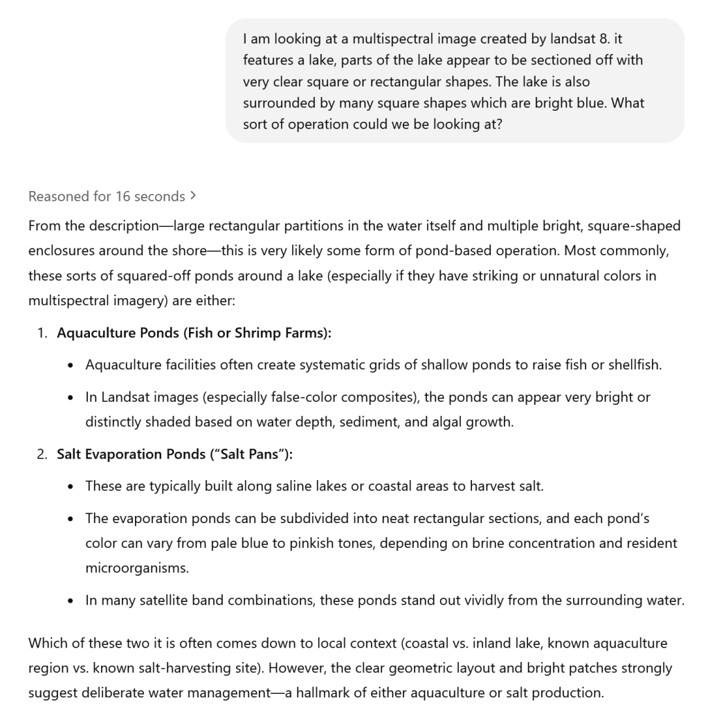
Given the comment about standing out vividly, I started on the assumption that these may be salt pans.
I searched for the largest salt panning operation based on a lake, and this was reported as Botswana’s Makgadikgadi. Looking at this on maps, it did not look like the right location, but I did identify an area showing the sale panning operation:
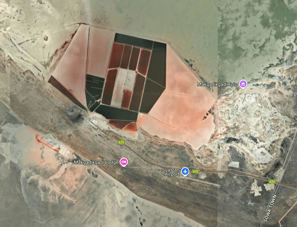
This looks like the type of shapes and structures that we may be seeing in the Landsat 8 image provided. This suggested to me that I may be on the right track thinking about salt pans.
I then ran a simple Google search to see if I could find other Landsat 8 images of salt pans on a lake for comparison to check that I was on the right path, or if I got lucky something that matches the image:
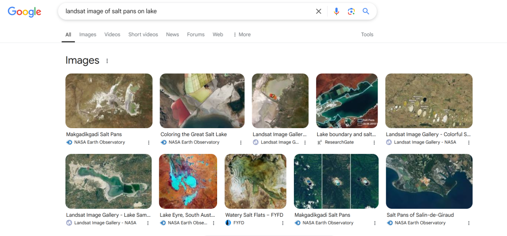
The bottom left image looked very similar:
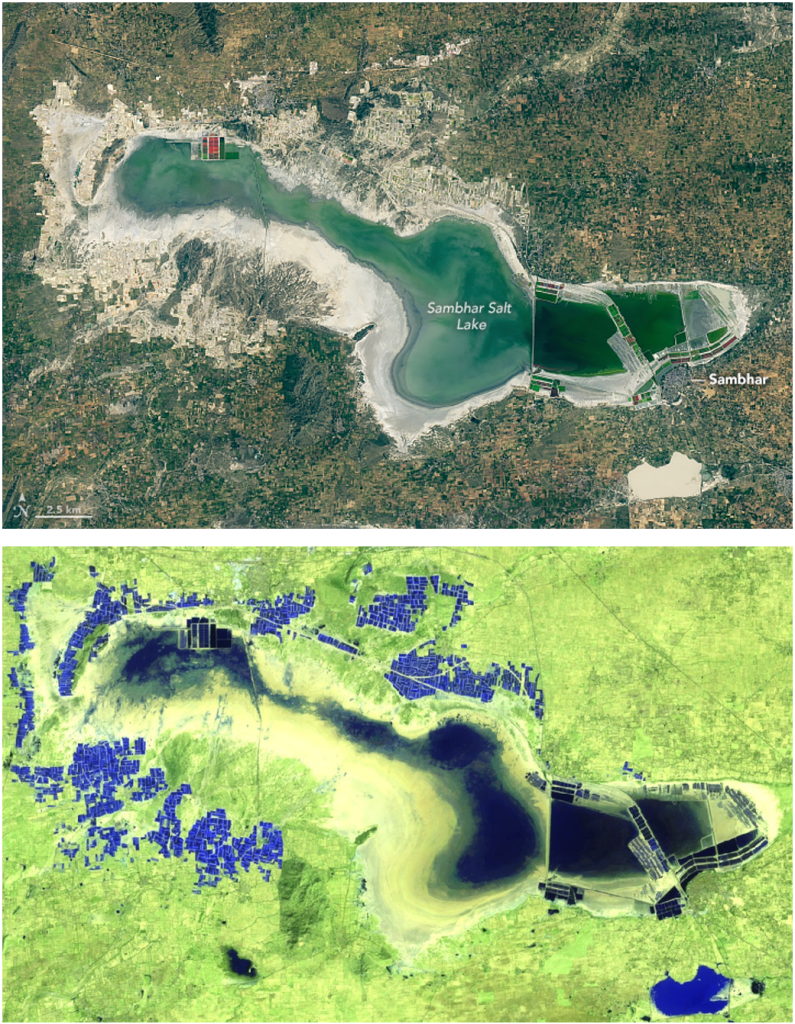
I believe that this is the location that we are looking for. The shape of the lake matches, as does the shape of the other object in the bottom right. All the structures on the lake also match, both on the right hand side and top left.
Recall that the challenge said to omit the “lake” descriptor. The image above suggests that the lake is Sambhar Salt Lake, so I initially tried “Sambhar Salt”, but this was incorrect. The name appears to just be Lake Sambhar, so we are looking for Sambhar.
Solution: Sambhar
04 – Kind of Blue
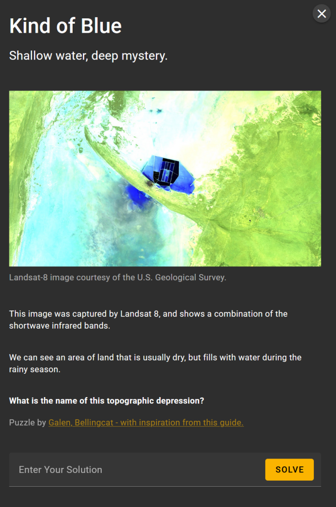
Hold on a second, that image looks familiar!
I managed to really luck out here, because of a search I ran in the previous challenge (Make the Water Turn Black).
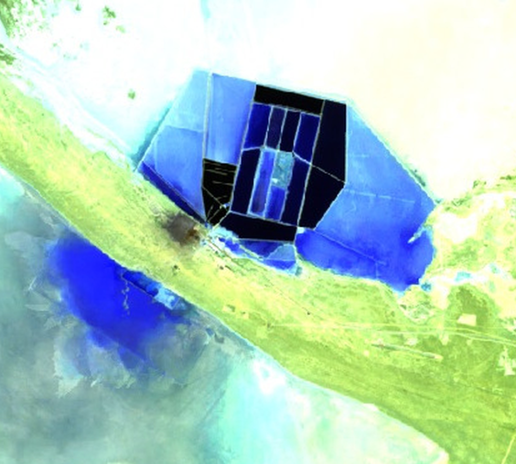
I was searching for the largest salt pans based on lakes, and discovered a report that this was Makgadikgadi in Botswana, and I found the below image from Google Maps, showing the Sowa Pan:

This matches the image in the challenge:
So, we know we are looking at the Sowa Pan, (or Sua Pan) in Botswana.
From Wikipedia:
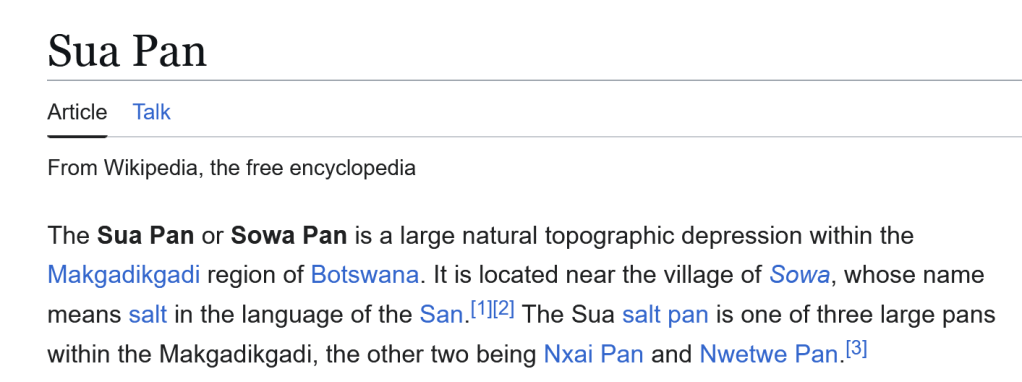
So Sua Pan is the name of the topographical depression.
Solution: Sua Pan
05 – Dandelion
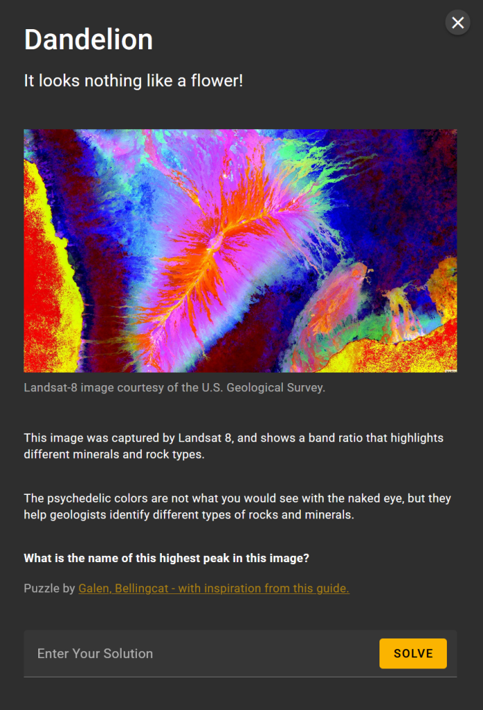
I took this to ChatGPT to see if we could get a quick answer (and hopefully a better response than Geo Guesser):
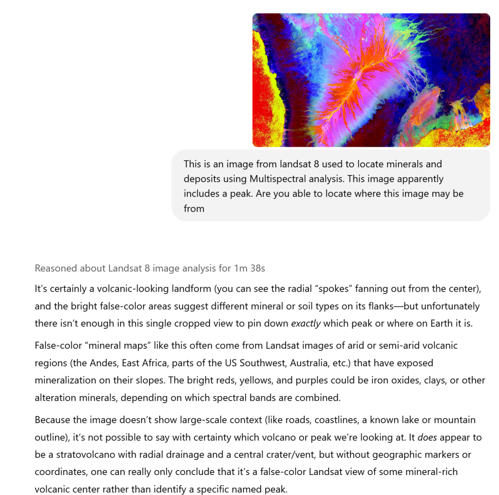
The peak is quite clear in the image, but I thought that the red and yellow may indicate the sea, meaning that this would be coastal, or more likely an island, given that there is sea on at least two sides. I asked ChatGPT:
So, ChatGPT doesn’t thing so… but thankfully we know better than to believe AI…
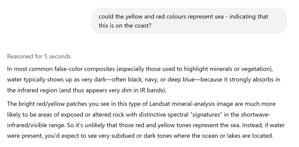
I opened up the Bellingcat multispectral tool (https://bellingcat-ee.projects.earthengine.app/view/multispectral-satellite-imagery-explorer).
I set the view to mineral zone contrast band (based on the description in the text of the challenge, and also the file name of the image “LandsatMineralZone-Cacrw1ao”).
Using the tool on this setting, I viewed London and the southeast coast of the UK:
It looks like I was indeed correct, and that the yellow and red could represent how the sea is shown in this type of multispectral image.
I therefore started looking at different volcanic islands and island groups in the tool:
Tristan Da Cuhna:
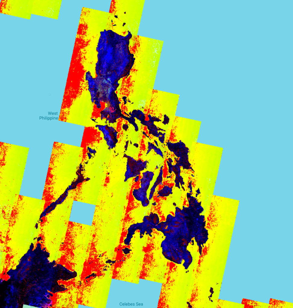
Philippines:
Hawaii:
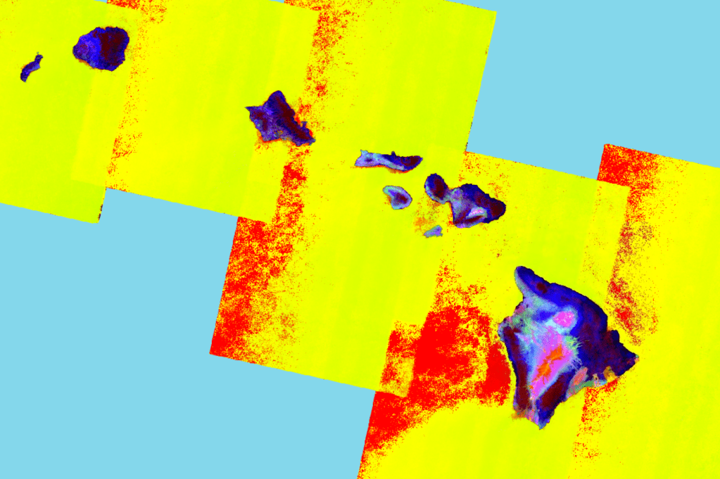
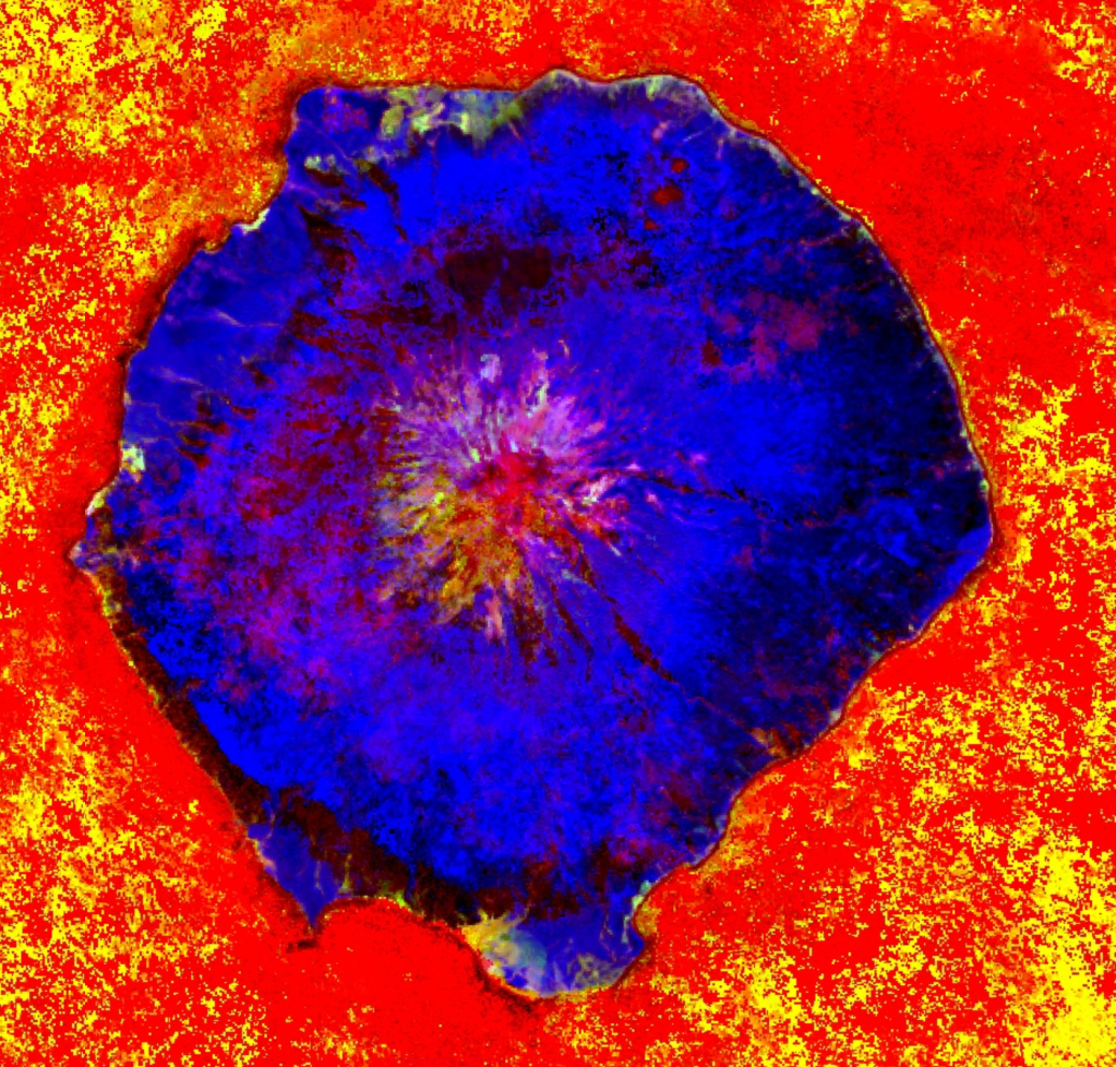
Bingo – It looks like we may have found a match. Zooming in:
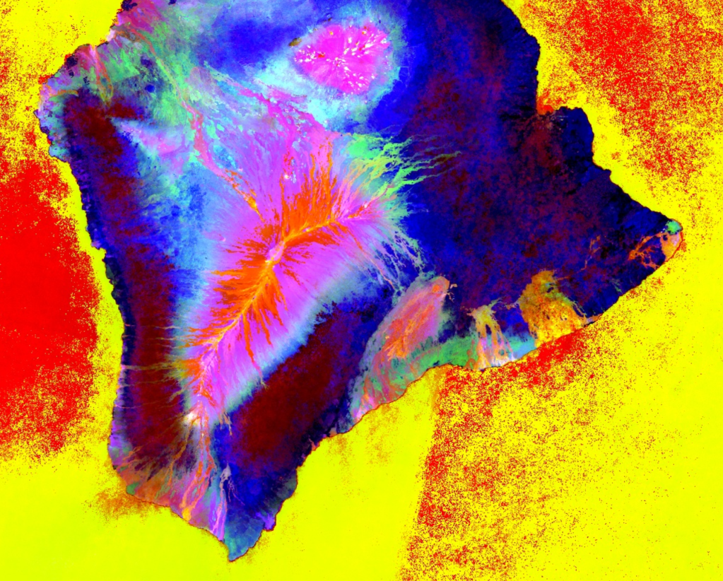
This is a match. This is Big Island in Hawaii. If we change the view, we can see that the main peak is Mauna Loa:
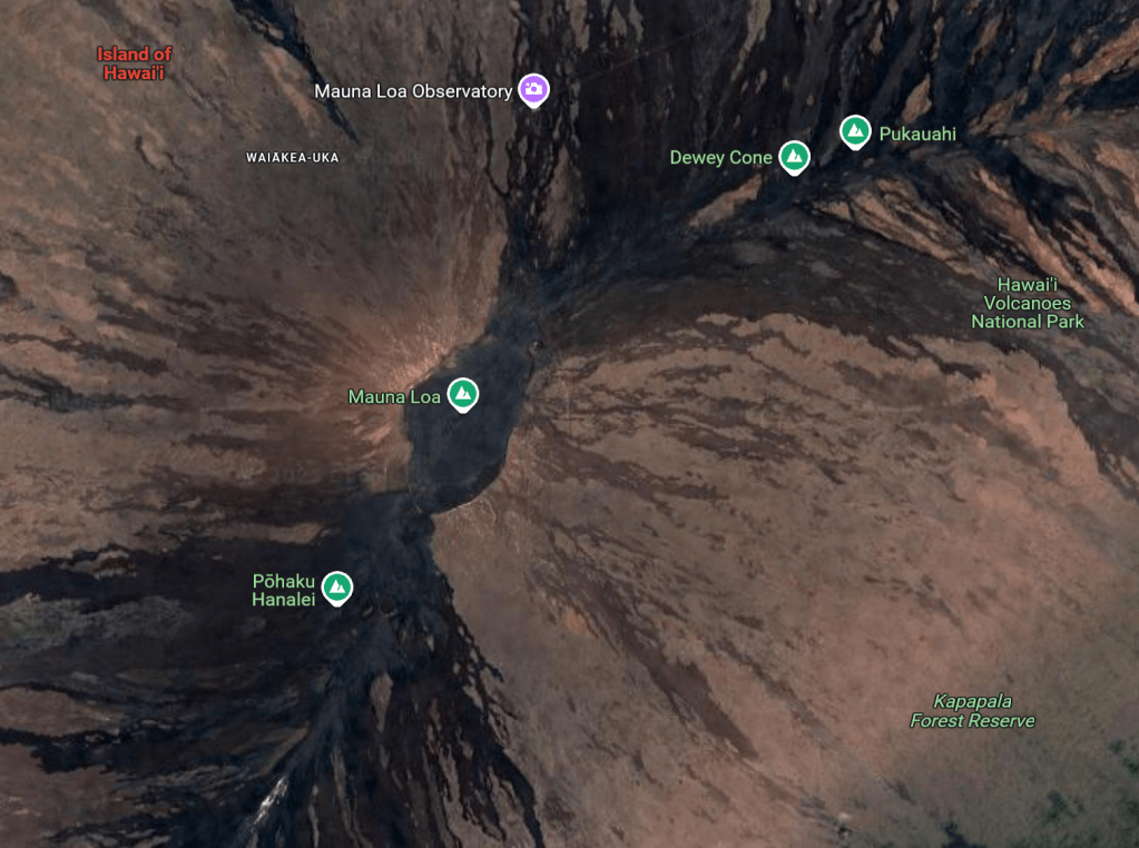
Solution: Mauna Loa
