
By Dr Tristan Jenkinson
Introduction
The July Bellingcat Challenges were titled “The Forgotten Files” and were set by researcher Peter Barth, whose investigation into the murder of a Texas oil baron is helpful in one of the challenges below (you can watch a video covering the investigation here – https://www.youtube.com/watch?v=TZcWblhJc_k). Peters challenges are really about digging into the past to unearth secrets that some might want to remain hidden.
Lets dive in.
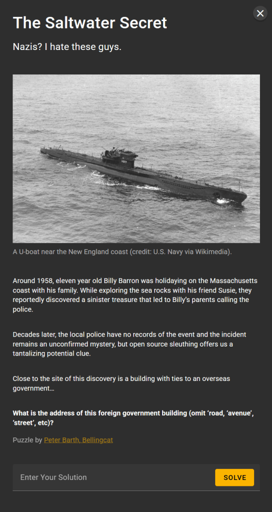
The Saltwater Secret
Running a quick Google search for likely terms finds what appears to be a relevant hit:
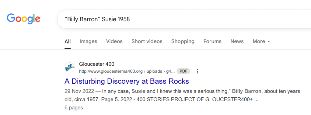
The link is to a pdf (http://www.gloucesterma400.org/wp-content/uploads/g400-stories-disturbing-discovery-fin-1.pdf). This is one of a series of short stories about the local community in Gloucester, Massachusetts. One section of the PDF provides the basis of the story, and why the box was of such interest:

The title gives further indications of the location (“A Disturbing Discovery at Bass Rocks”) the article also describes the location of the find as Goodharbour beach.
A quick search on Google Maps and we can find (the slightly different spelling) “Good Harbor Beach”, and next to the beach, “Bass Rocks”.

Running various searches looking for Government buildings or former government buildings, across both Google and ChatGPT. I was not able to find anything.
I therefore started an alternative approach, looking for historic buildings, which I thought might assist.
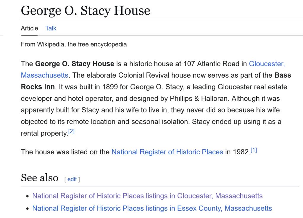
Running a Google Search for historic building bass rocks Gloucester returned a number of entries, including a link to George O. Stacy House on Wikipedia – https://en.wikipedia.org/wiki/George_O._Stacy_House.
While this did not look like it was necessarily the location that I was looking for, it included a link to the National Register of Historic Places listing for Gloucester:
This register seems like it may be a good place to check, as former government buildings may well be listed as historic. There are 35 entries, I am interested in those which are close to the Bass Rocks location. Therefore looked at the option to map the locations to OpenStreetMap.
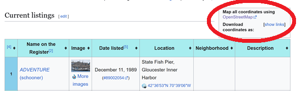
There is only one location near Bass Rocks:
This is the George O. Stacy House, already identified above, but I could find no indication that this has ties to any foreign government.
I ran a number of further searches, adding in terms that might be linked to official representatives from a country.
After a number of attempts, I tried the below:

Just from the cached information displayed by Google, we now have two locations to check out further – Gloucester Inn by the Sea and Harding Cottage… but let’s check the link for more information (https://eu.wickedlocal.com/story/cape-ann-beacon/2009/08/28/royal-roots-city-celebrates-era/39377327007/)
The opening paragraph suggests that this was not just a visit, but an annual visit:
“Ninety three years ago this Sunday, Prince Mahidol of Thailand arrived in Gloucester on the 5:52 p.m. train. The 24-year-old member of the Thai royal family stayed at what is now the Gloucester Inn by the Sea and spent most days at Harding Cottage at 3 Page St. near Bass Rocks. It was the beginning of an enduring love for the area, which he returned to most summers over the next 12 years while he studied public health at Harvard.”
Further down the article, we have what may be the answer we are looking for:
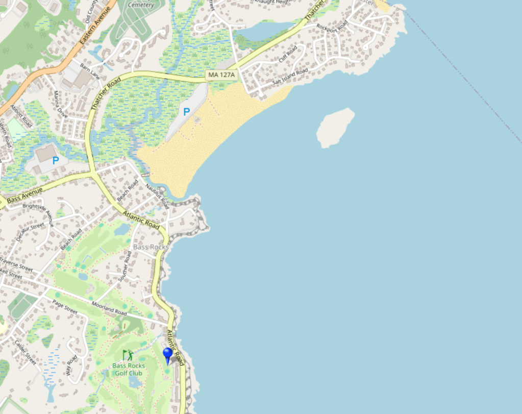
“In recognition of the little known but significant connection between the Thai Royal Family and the city of Gloucester, two bronze plaques will be installed this Sunday at 3 Page St. and 24 Bass Rocks Road, the former summer residence of the Siamese Legation for over 50 years.”
Well, Bass Rocks Road is definitely “near” to the discovery location (given that it was describes as being at Bass Rocks), it is also the former summer residence of the Siamese legation, which would be the link to foreign government that we are looking for.
Before submitting the answer, can we find the plaque?
Using Google maps, I travelled to 24 Bass Rocks Road, and can locate a plaque, but it is obscured by a car (and what is visible is illegible):

The plaque is unobscured from further away, but is still, unfortunately, illegible:

Running a Google Search, and flipping across to the image view, we can find an image that looks promising:
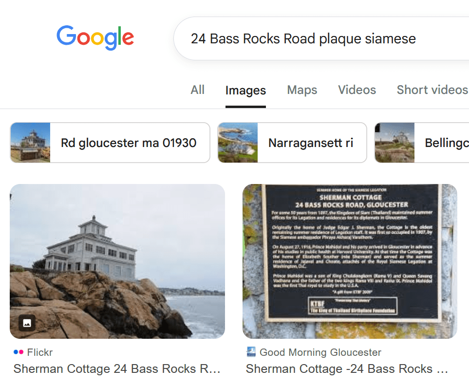
This article from Good Morning Gloucester covers the unveiling of the plaque:
Including the image of the plaque itself:

Our solution is therefore:
Solution:24 Bass Rocks
A Hitman’s Hobby

A quick Google to see if we can find some good leads, identified that we may need to look for an alternative name:

So we may want to try Paul Adams Gibbs as an alternative if needed.
It also seems likely that if the information we are looking for is in a prison newspaper, then it would likely be the prison that Gibbs was detained in.
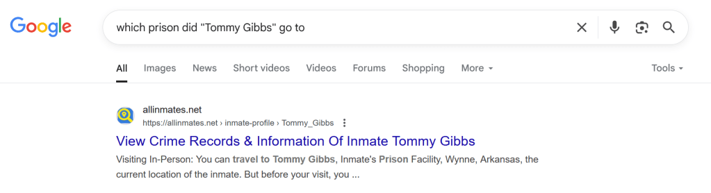
I ran a simple Google search:
The image appearing in this challenge is listed as being painted by Ann Kiernan for Bellingcat. This does beg the question of if this image was created just for this challenge, or something else…
I Googled to out if there was any other prior content:

So we have some prior material here, from earlier this year – a Bellingcat article (https://www.bellingcat.com/news/2025/05/27/pigeon-shoots-and-hitmen-new-leads-in-a-texas-oilmans-cold-case/). This is the article documenting some of the investigation work performed by Peter Barth into the murder of an oil baron.
In the article, there is a link in the article to a “prison run newspaper” – https://texashistory.unt.edu/ark:/67531/metapth1732148/m1/4/?q=%22Tommy+Gibbs%22
This is the Texas Echo, described as a “Monthly newspaper produced for inmates in the Texas criminal justice system containing news stories, policy updates, opinion pieces, creative works, and other information.”.
I ran a search for Tommy Gibbs over all the editions of the Echo.
The below are the entries that I found:
The Echo (Huntsville, Tex.), Vol. 39, No. 2, Ed. 1 Thursday, February 1, 1968:
“Tommy Gibbs has been assigned as bookkeeper for the Maintenance Shop and is the only bookkeeper on the farm who wears and electricians pouch…”
The Echo (Huntsville, Tex.), Vol. 37, No. 2, Ed. 1 Tuesday, February 1, 1966:
“Tommy Gibbs now on pill line still wondering why he is the only man with a prescription for tranquilisers issued solely because of his looks.”
The Echo (Huntsville, Tex.), Vol. 32, No. 9, Ed. 1 Tuesday, August 1, 1961:
“Tommy Gibbs is busy with a whole bunch of old and new watches sent in; he’ll be all wrapped up for a while”.
The Echo (Huntsville, Tex.), Vol. 32, No. 7, Ed. 1 Thursday, June 1, 1961:
“Not too many people in prison are unselfish. Too often it’s the other way around, so it’s refreshing to find the good ones – Tommy Gibbs has a hobby of watch making and repair; keeps him busy and fills a need. The nice thing is that he fixes them for broke people too, always with a smile, makes them feel good about it, and there aren’t too many of those kind of people in here.”
Solution: Watch making
The Citrus Conspiracy

The Editor comment suggests that this may not be the actual name of the club that we are looking for. Therefore I ran a looser search:

The club that attracted unsavoury characters, especially associated with the Dixie Mafia (who were mentioned in Peter Barth’s Bellingcat article that we uncovered looking for information on Tommy Gibbs, discussed above).
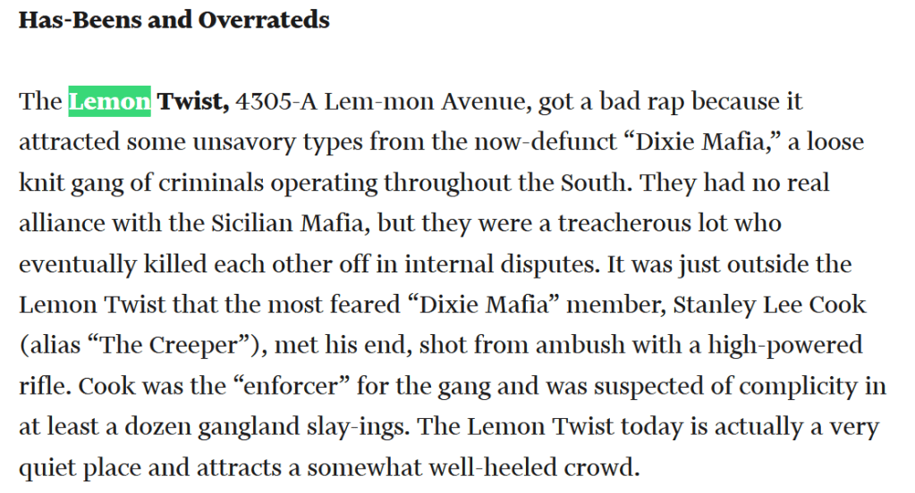
So lets check the Lemon Twist. The link next to this is to the Meanest Bars in Dallas article on the right hand side – https://www.dmagazine.com/publications/d-magazine/1975/july/the-meanest-bars-in-dallas/
This article contains the below, which identifies the address (4305A Lemmon Avenue) and confirms that a gang shooting occurred outside:
Having found the Texas Echo online on a page titled “texashistory” in the prior challenge, I decided to head back there and see if, in addition to online copies of newspapers, they also had telephone directories.
Running a search over all of their documents for “Lemon Twist” Lemmon, I was able to find 11 hits, in Greater Dallas White and Yellow pages.
I opened the 1971 version, and found the search hit on Lemon Twist:

This gives the phone number 526-1190 (and this fits the format required).
Now I want to find the neighbouring business.
While I had the 1971 Greater Dallas Yellow pages open, I decided to use it.
I searched first for 4305 Lemmon, this is reported as Guerro’s Barber Shop:

I also looked out 4303 and 4307
4303 is Kentucky Fried Chicken:
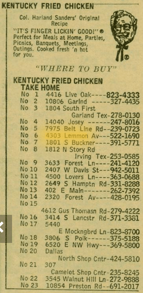
4307 is Top Flite Liqr store:

Now using Google Maps, I headed to 4305 Lemmon Avenue
It appears that Guerrero’s has gone, and Top Elite Lqr has become Top Nailspa… but at number 4303:
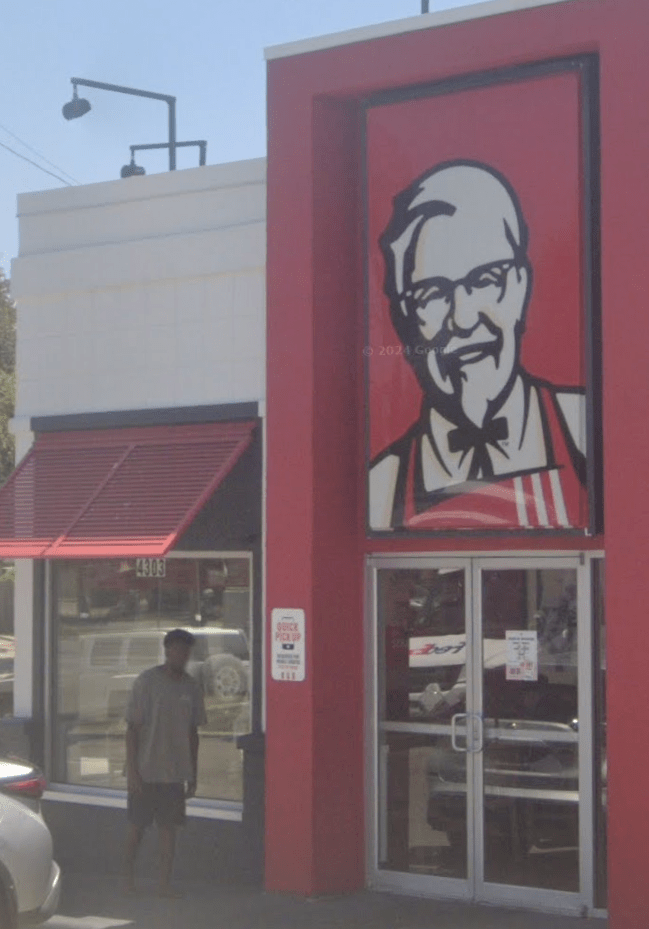
Kentucky Fried Chicken is still there.
So our answer is 526-1190 Kentucky Fried Chicken.
Though the solution required the abbreviation.
Solution: 526-1190 KFC
Beyond the Fence

Saving out the map I was able to use some of the points listed on the map to find its location, specifically locating Clausdorf as Klausdorf, then we can see that the map matches up:
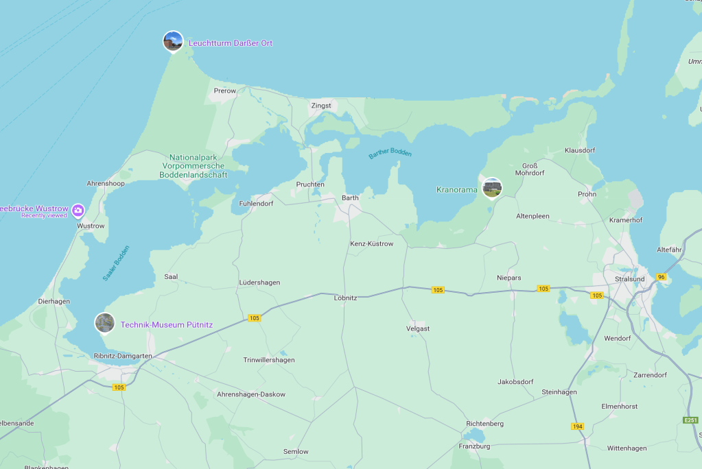

We can see that the Western gun point is near Wustrow.
Googling this We can find a CIA report on the Wustrow Peninsular AAA (AntiAircraft) firing range (https://www.cia.gov/readingroom/docs/CIA-RDP80-00809A000600010207-7.pdf)
The first paragraph of this document provides the following location:

However, this is a location further down the coast, near Rerik, not actually in Wustrow:

I therefore went back to Google maps, and used streetview to look at the relevant area around Wustrow.

Compared to the hand drawn map supplied:

According to Google Maps, the location is 54.3444579,12.3806186.
To three decimal places, this is 54.344,12.381
This is incorrect… however, some additional Googling around Wustrow found this image (https://www.alamy.com/remains-of-a-german-bunker-from-the-second-world-war-at-the-baltic-sea-beach-of-wustrow-germany-image222223324.html)

This led me to the bunker in Wustrow on Google Maps, which somehow I had missed, which is slightly further north than I had been looking:

We can see that the original bunker is starting to fall into the sea. A drone view from slightly further south shows the area well:
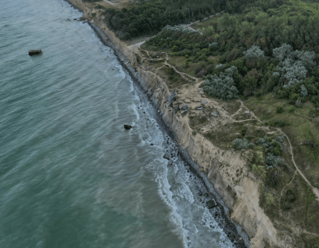
If we click on one of the photos from the bunker, we can see some of the structure in place:

Based on Google Maps, this is at @54.3609613,12.3963653
So to three decimal places, this is 54.361, 12.396.
Next, we need to identify the sea base marked in the East. This appears to be near Kramerhof:

I did experience an AI fail that I thought might be interesting to mention here:
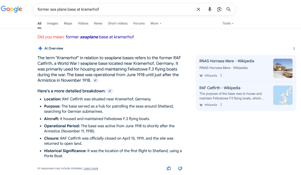
RAF Catfirth is in the Shetlands, to the Northeast of Scotland… it is very much not near Kramerhof in Germany. This is something that the AI also seems to identify, as it states that it was used to patrolling around Shetland and was the site of the first flight to Shetland… so how could it be near Kramerhof in Germany? An interesting point, but not one for further discussion here.
I did find a directory of military airfields – https://www.mil-airfields.de/
Opening this and running some searches, I was able to identify the below map at https://www.mil-airfields.de/maps/flugplatzkarte-n54e012.htm:
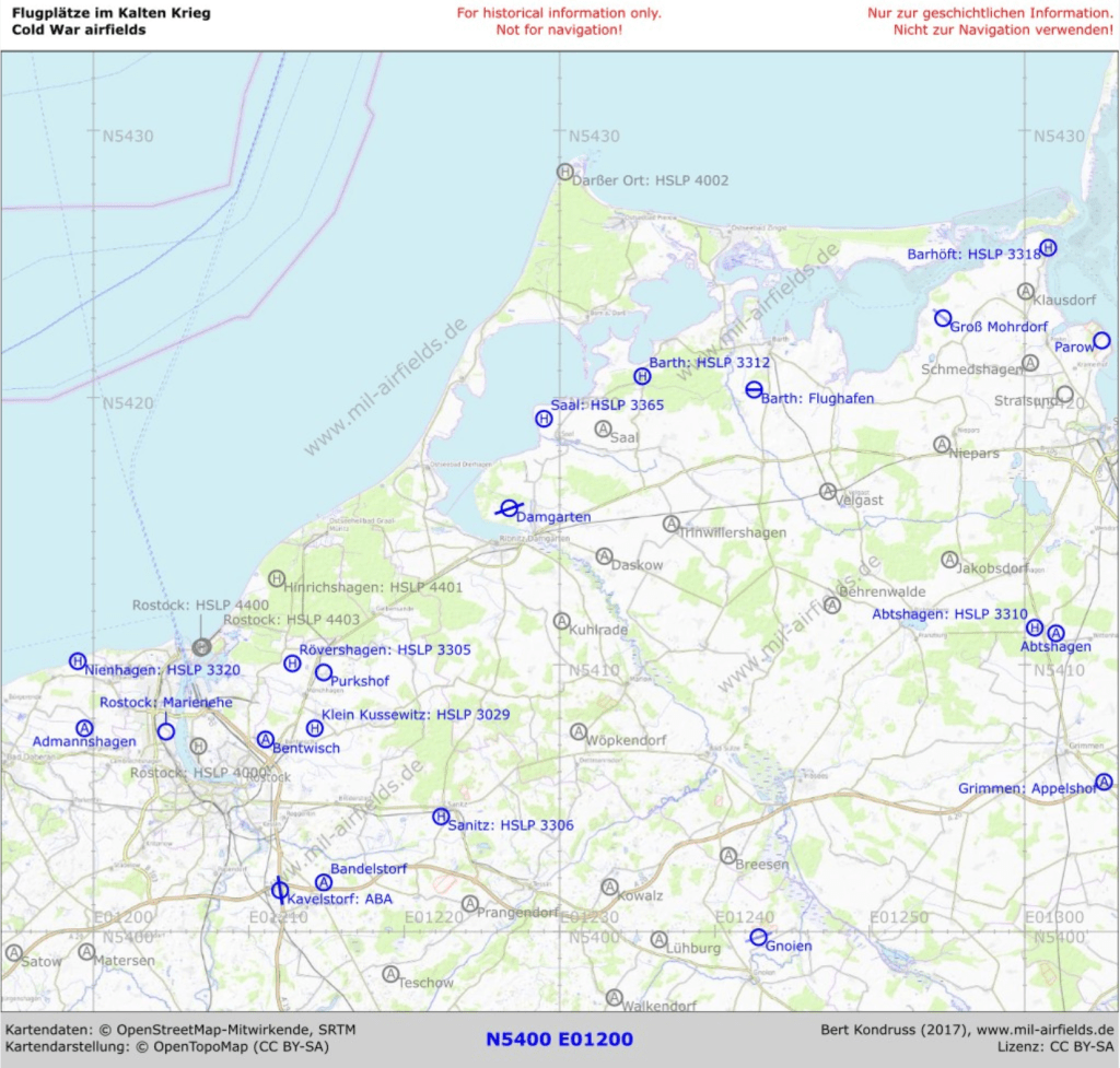
In the top right, we can see Parow listed where we are looking for a sea plane base.
There is a link with more information on Parow, https://www.mil-airfields.de/de/parow-airbase.htm.
We can see in Parow highlighted in the map below:
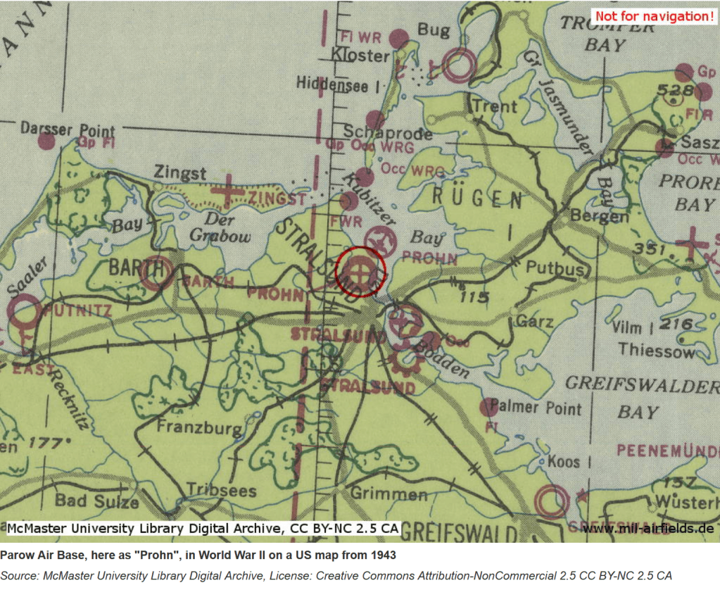
Putting the two sections together
Solution: 54.361, 12.396 Parow
Slaughter and Salvation

We can see the church in the bottom right quadrant of the map:
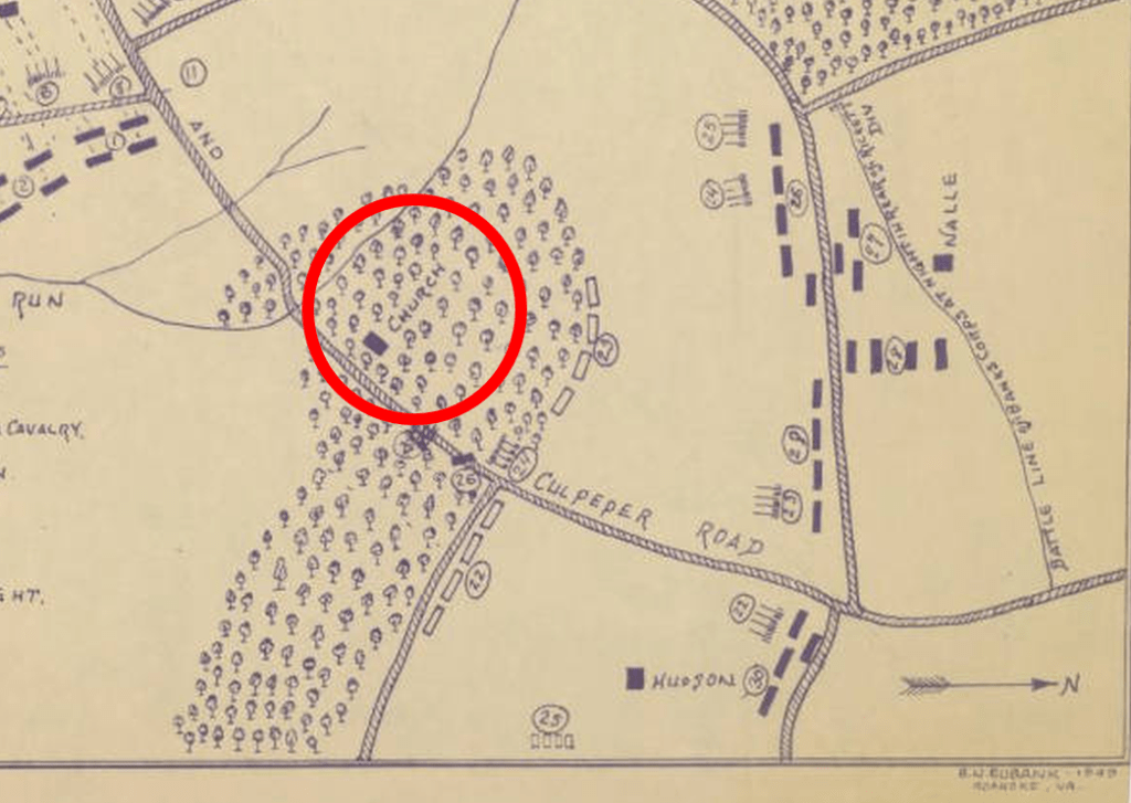
We can also see that the church is on Culpeper road, and key to note is that we have the arrow in the bottom right indicating that North is to the right of the image, so this is not oriented as we would normally expect.
If we look at the map, the church appears to be on Culpeper Road, though looking to the West, we can see that the road appears to be labelled Orange and Culpeper Road.
A quick Google identifies that Cedar Mountain is also known as Cedar Run. Using Bellingcat’s OpenSteetMap tool (https://osm-search.bellingcat.com/) we can look for Churches around the area of Cedar run:

Only one of these is near to the river (Cedar Run):
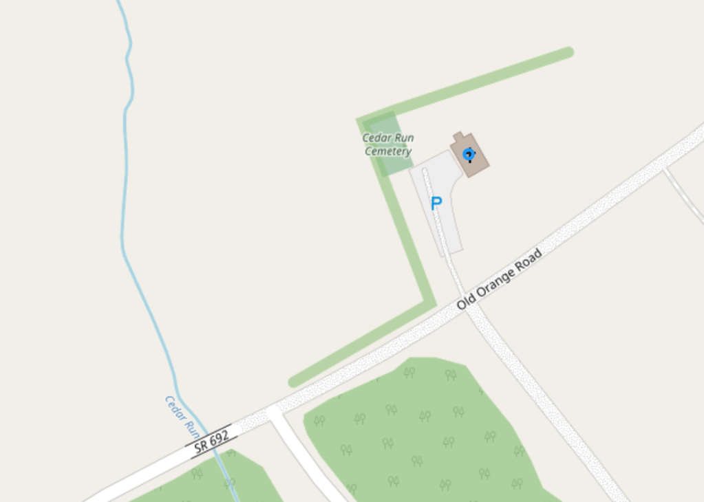
This is the Cedar Run Baptist Church on Old Orange Road, near to where the Cedar Run River crosses that road. It seems likely that “Old Orange Road” may well be the renamed “Orange and Culpeper Road”.
If we rotate the provided map, we can compare this to openstreetmap we can see that this may well represent the position of the church as it was:

This seems to be the most likely, as it is the only church near the Cedar Run.
Therefore, we want to find out how much the Cedar Run Baptist Church cost, running a simple Google search, identifies this:

Solution: 1450

One thought on “Bellingcat Challenge – July 2025 (The Forgotten Files)”